XR-RD06 series
 1.Product overview
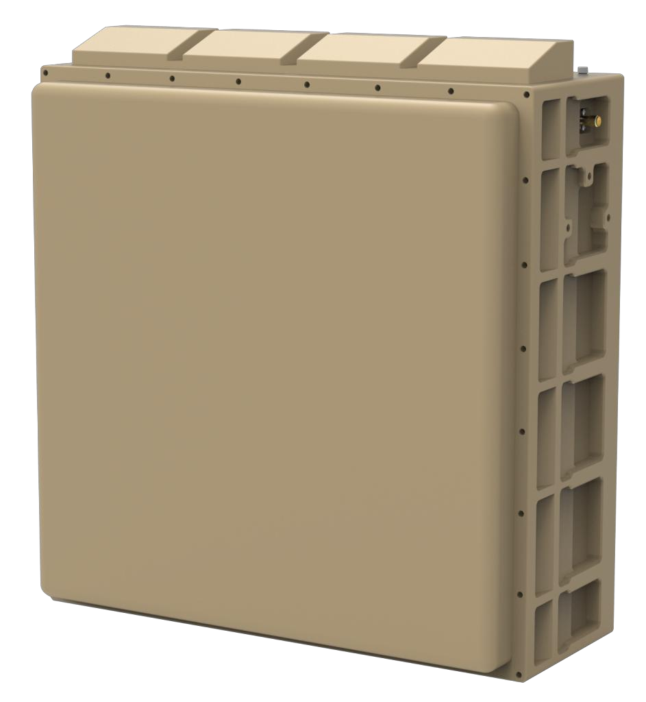
XR-RD06 series X-band four-sided array radar, which based on all-solid-state, fully coherent, pulse Doppler system, using machine learning and AI intelligent recognition technology to detect, track and identify "low, small and slow" targets with all weather. Compared with Sweep scan radar, the radar can provide multi-target tracking function, which has higher reliability and better recognition ability. This series of radar products provide 3 detection ability for 3km/5km/8km.
2. Technical indicators
|
Type |
XR-RD06A |
XR-RD06B |
XR-RD06C |
|
Frequency |
X-band |
||
|
Detection |
≥5Km (RCS: 0.01㎡) |
≥8Km (RCS: 0.01㎡) |
≥3Km (RCS: 0.01㎡) |
|
Blind Zone |
≤200m |
||
|
Field of View |
Azimuth: ±45° , Elevation: 0°~30° (Elevation can be configured) |
||
|
Tracking |
TAS functionality |
||
|
TAS Number |
≥6 |
||
|
Speed |
1m/s~ 100m/s |
||
|
Accuracy |
Distance: <10m, Azimuth:<0.5° , Elevation: <0.5° |
||
|
Update Rate |
Search: ≤3.5s, TAS: ≤0.5s |
||
|
Weight |
≤13Kg |
≤15Kg |
≤13Kg |
|
Power |
DC24V/220VAC |
||
|
Operating Power |
≤300W |
≤500W |
≤220W |
|
Size |
≤335mm*315mm*133mm |
≤335mm*315mm*160mm |
≤335mm*315mm*133mm |
|
Operating Temp |
-40℃~+70℃ |
-40℃~+60℃ |
-40℃~+70℃ |
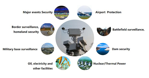
3. App l icat ion f ie ld
4. techn ica l character ist ics
1) series, more products
Multi-band : a series radars include X band and Ku band ;
Wide range : provide the series radars which detect the UAV of RCS=0.01 ㎡ from 1.5km to 10km ;
2) Excellent performance and full function
Intelligent : machine learning technology, adaptive position environment automatically, which the radar works directly after changing the work position.
Strong detection : a series radars with high detection ability, low false alarm, which can detect high-speed maneuverable flying UAV stably ;
Full function : a series radars for all the environments including low altitude, ground or sea ;
AI : AI technology used to achieve Classification and recognition for the targets such as drones, birds, people and vehicles etc ;
All-weather : a series radars with cloud and rain clutter suppression function, which work with all-weather condition ;
Automation : built-in the inclinometer module and GPS module, which realize the angle compensation and north calibration function automatically.
3) Sof tware definition
Elevation settings : Elevation coverage can be configured ;
Range settings : different ranges can be configured ;
Mode settings : different working modes can be configured (such as switching sweep scanning mode and phase scanning mode ) ;
Update rate settings: different target update rates can be configured.